Aerials are cool...

Modern Muzzleloading Forum

Help Support Modern Muzzleloading Forum:

This site may earn a commission from merchant affiliate links, including eBay, Amazon, and others.

Marty1

Well-Known Member
Joined
Feb 3, 2009
Messages
4,008
Reaction score
236
inSo1TK.jpg

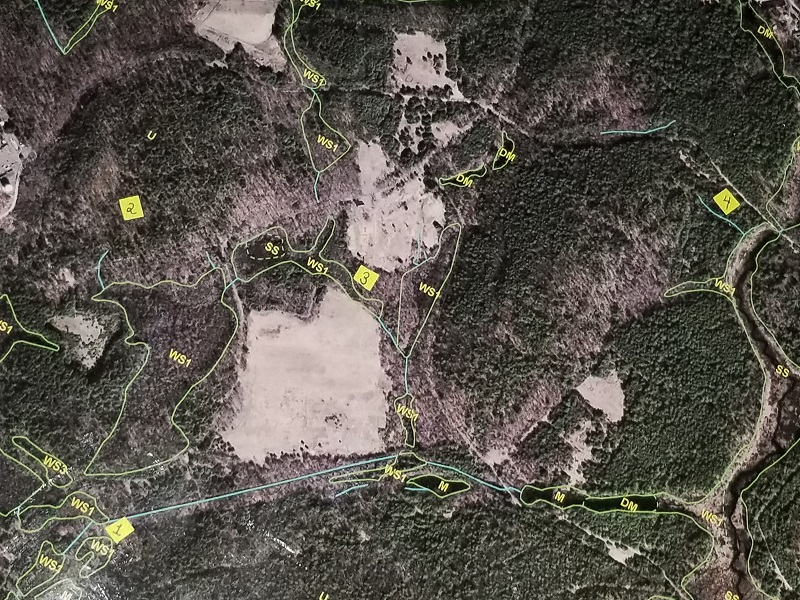
I always ponder a question when I harvest a deer.  Why was this deer here?  With today’s technology we’re able to go back and grab a bird’s-eye-view of our past hunting grounds for hints to the answer.  If you hunt on protected public land like I do on occasion, chances are the land features have not changed much over time. Curious I went back to one of those “default” stomping grounds and plotted on aerial four locations where I have taken deer.  An easily accessible aerial view like this was practically unimaginable to your everyday hunter 30-40 years ago.  Back in the day all I ever scouted with was a compass and a crumbled-up, marked-up, 7.5 minute U.S.G.S. quad map… no G.P.S. common smart phone gadgetry aids back then.  Unlike topo maps, aerials can provide valuable vegetative information.  In fact, if you have access to the software it’s relatively easy to overlay an aerial with topographic contour lines. 

If I were to again hunt the area in the photo, as memory recalls, I’d likely start-off at one of the four locations to plop myself down given the following:

Location <a href='/tags/3' rel='nofollow' title='See all tagged subjects with: #3'>#3</a> -  A narrow woodland strip between two open fields.     
Location <a href='/tags/2' rel='nofollow' title='See all tagged subjects with: #2'>#2</a> - A central upland area where several deer trails converged.
Location <a href='/tags/1' rel='nofollow' title='See all tagged subjects with: #1'>#1</a> – Edge of a heavily wooded swamp.
Location <a href='/tags/4' rel='nofollow' title='See all tagged subjects with: #4'>#4</a> - A deer trail paralleling a wetlands corridor. 
----------------------------------------------------------------------------------------------------------
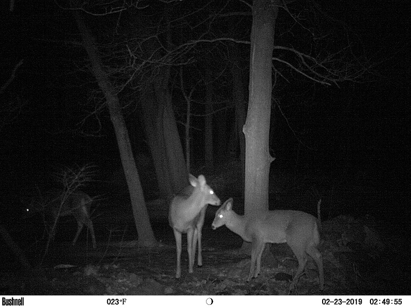
p.s. Ground photos are  8)  too.  Here’s a trail cam pic from just last night.
[font=Verdana, sans-serif]
ArJ6CkI.jpg
[/font]
 
.
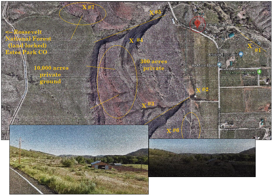
Here's the map from Google taken a few years ago for our 300 acres and adjoining private lands of neighbors that we had permission to hunt.  We didn't want to over hunt this area so we kept it limited to a small group of guys that we knew would be careful with live stock around.

masonville.jpg
Not as detailed as yours Marty, but with the numbering we knew who was in those  locations for providing help with getting deer, elk or bear out and an idea where someone was if shooting.​
Location #Home  - Meeting place at my store, 4 AM breakfast (home made everything from bread to full blown meal), 
                           planning and the place for meat to be hung in barn when taken.     
Location #1        - A narrow woodland strip with a 50' wide creek (watering hole) between lower open fields.     
Location #2        - A central area where several deer trails cross at base of hillside (approach with care).
Location #3, 4    - Edge of a 500' cliffs, good area to see what's going on (lots of cover for viewing).
Location #       - A deer trail paralleling a large plowed field with grass (excellent spot for long shots).
Location #       - Steep hillside where elk like to lay and watch the lower fields (come in above them). 
Location #7        - Deer trail where game comes up out of fields (good spot for bear trying to get feed).
 
That takes the fun and skill out of scouting. I prefer the boots method but that's me.
 
When your limited on time (weekend) and a half dozen guys trying to out do the other with the game taken, scouting for what you want and getting as close as possible was the name of the game.  We shot muzzleloaders no matter what the season was.  

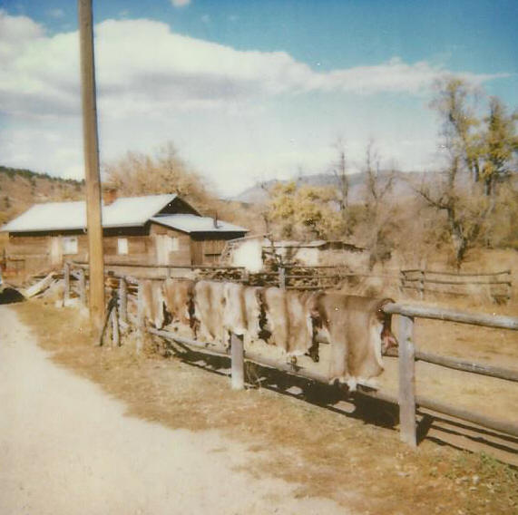
We would hang the hides on the corral fence by the store for customers to look at and talk to the guys that did the shooting. There was allot of coffee drank and homemade donuts eaten by everyone (all provided by Buckhorn Rendezvous Inc.) - my accountant would just scratch her head with this expense - It's called advertising dear !!!   :)   8)

deerhides.jpg
Under the old homestead (seen in background) we had a freezer (locker) box off an old truck we used to hang the meat in and let it age.  A cutting table from the National Guard was in the basement along with the locker for taking care of cutting and grinding the game. And a stone smoke house for used for that purpose that was built according to date on building in 1879.  Fun times.​
 
love the aerial stuff! Last year i went onto google earth and looked at my hunting area, took multiple pictures and printed them out and scouted those areas from the maps i printed out. Paid off last year for us!
 
.
They save allot of time and leg work with the details being able to look at from above.  Biggest draw back if hunting public land is everyone now knows what you thought was only a few. Then its how far back are you willing to go - away from the road hunters that will only venture a mile or less from their vehicle.  The further away from an access road has always been the best plan for us.

__________________________________________________________​
Years ago we had scouted this water hole on the edge of Roosevelt NF (well tracked by deer and elk), we spent several weekends watching the animals come in and out of the site.  

Opening morning we went into the area at 3 AM thinking we'll beat the game and be setup and ready. This is like an eighth of a mile radius around the hole, about day light here's another hunter 400-500 yards away on the other side of the watering hole, that's fine. 

As the sun comes up he's holding a white sheet of paper up like he's reading something? All of a sudden he holds his rifle up and BANG - the gun goes off. My friend and myself are beside ourselves. We work our way around to him (any game is now a mile way).  My friend says "what in the hell are you doing, you just scared any and everything off"?  

We find out he's never even shot a muzzleloader before and had his neighbor load the gun (new TC Hawken). He read in the manuel (white paper in the air) to snap a cap, wonderful guy.  Made our day, we went on down the trail.   :evil:
 
Cool pics Buck'. Thanks for sharing a bird's view of the ol' hunting area.  That historic snapshot with the hides is really awesome!  I find old hunting photos like that really interesting...especially if there's a story behind them.  They are great conversation pieces capturing a bit of history the way it once was. 
Using aerials will give you that big picture overview of one's hunting area.  However, like the OldMntMan said, you still need to fine-tune your hunting spot on the ground.
----------------------------------------------------


p.s.  If you're looking for detailed mapping of a particular area to hunt, most states offer their G.I.S. (Geographic Information System) free of charge without having to buy the software.   My aerial photo was G.I.S. generated. Just Google your home state + G.l.S.  
 
Thank you Marty, they save getting "misplaced" as Pete would say, we would say "lost".   :lol!:
 
Back
Top